Tomeki

Explore Books on
imaging systems in geophysics

1-24 of 28 Books

View Measuring human-induced land subsidence from space By Geological Survey (U.S.)

Measuring human-induced land subsidence from space

Measuring human-induced land subsidence from space

By Geological Survey (U.S.)

View Europa The Ocean Moon By Richard J. Greenberg
Cover of Europa  The Ocean Moon by richard j. greenberg

Europa The Ocean Moon

By Richard J. Greenberg

View Radar interferometry By Ramon F. Hanssen
Cover of Radar interferometry by ramon f. hanssen

Radar interferometry

By Ramon F. Hanssen

View Inner Magnetospher Imager (IMI) instrument heritage By Gordon R. Wilson

Inner Magnetospher Imager (IMI) instrument heritage

Inner Magnetospher Imager (IMI) instrument heritage

By Gordon R. Wilson

View Seeing into the Earth By National Research Council (US)
Cover of Seeing into the Earth by national research council (us)

Seeing into the Earth

By National Research Council (US)

View Landscapes Revealed By Amanda Brend,Nick Card,Jane Downes,Mark Edmonds,James Moore
Cover of Landscapes Revealed by amanda brend,nick card,jane downes,mark edmonds,james moore

Landscapes Revealed

By Amanda Brend,Nick Card,Jane Downes,Mark Edmonds,James Moore

View Advances in studies of heterogeneities in the Earth's lithosphere By Keiiti Aki,Yehuda Ben-Zion,William Hung Kan Lee
Cover of Advances in studies of heterogeneities in the Earth's lithosphere by keiiti aki,yehuda ben-zion,william hung kan lee

Advances in studies of heterogeneities in the Earth's lithosphere

By Keiiti Aki,Yehuda Ben-Zion,William Hung Kan Lee

View Tomography of the Earth's crust By Weber, Michael,Ute Münch
Cover of Tomography of the Earth's crust by weber, michael,ute münch

Tomography of the Earth's crust

By Weber, Michael,Ute Münch

View Borehole imaging By P. K. Harvey
Cover of Borehole imaging by p. k. harvey

Borehole imaging

By P. K. Harvey

View Imaging, mapping and modelling continental lithosphere extension and breakup By Garry D. Karner,L. Pinheiro
Cover of Imaging, mapping and modelling continental lithosphere extension and breakup by garry d. karner,l. pinheiro

Imaging, mapping and modelling continental lithosphere extension and breakup

By Garry D. Karner,L. Pinheiro

View The Seismic Velocity Model as an Interpretation Asset (Distinguished Instructor Series, Number 2) By Phil Shultz
Cover of The Seismic Velocity Model as an Interpretation Asset (Distinguished Instructor Series, Number 2) by phil shultz

The Seismic Velocity Model as an Interpretation Asset (Distinguished Instructor Series, Number 2)

By Phil Shultz

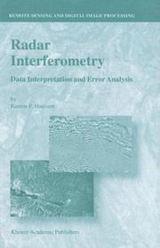
View Radar Interferometry - Data Interpretation and Error Analysis (Remote Sensing and Digital Image Processing, Volume 2) (Remote Sensing and Digital Image Processing) By R.F. Hanssen
Cover of Radar Interferometry - Data Interpretation and Error Analysis (Remote Sensing and Digital Image Processing, Volume 2) (Remote Sensing and Digital Image Processing) by r.f. hanssen

Radar Interferometry - Data Interpretation and Error Analysis (Remote Sensing and Digital Image Processing, Volume 2) (Remote Sensing and Digital Image Processing)

By R.F. Hanssen

View The seismic velocity model as an interpretation asset By Distinguished Instructor Short Course (2nd 1999 Tulsa, Okla.)

The seismic velocity model as an interpretation asset

The seismic velocity model as an interpretation asset

By Distinguished Instructor Short Course (2nd 1999 Tulsa, Okla.)

View Guardare all'interno delle murature By Nasser Abu Zeid

Guardare all'interno delle murature

Guardare all'interno delle murature

By Nasser Abu Zeid

View Mathematical methods in geophysical imaging By SPIE,Society of Exploration Geophysicists,Society for Industrial and Applied Mathematics
Cover of Mathematical methods in geophysical imaging by spie,society of exploration geophysicists,society for industrial and applied mathematics

Mathematical methods in geophysical imaging

By SPIE,Society of Exploration Geophysicists,Society for Industrial and Applied Mathematics

View Radar interferometry By Ramon F. Hanssen

Radar interferometry

Radar interferometry

By Ramon F. Hanssen

View The magnetotelluric method By Alan Dana Chave,Jones, Alan G. Dr
Cover of The magnetotelluric method by alan dana chave,jones, alan g. dr

The magnetotelluric method

By Alan Dana Chave,Jones, Alan G. Dr

View Satellite Radar Interferometry By V. B. H. (Gini) Ketelaar
Cover of Satellite Radar Interferometry by v. b. h. (gini) ketelaar

Satellite Radar Interferometry

By V. B. H. (Gini) Ketelaar

View Mathematical methods in geophysical imaging V By Siamak Hassanzadeh
Cover of Mathematical methods in geophysical imaging V by siamak hassanzadeh

Mathematical methods in geophysical imaging V

By Siamak Hassanzadeh

View Mathematical methods in geophysical imaging III By Siamak Hassanzadeh
Cover of Mathematical methods in geophysical imaging III by siamak hassanzadeh

Mathematical methods in geophysical imaging III

By Siamak Hassanzadeh

View Measuring human-induced land subsidence from space By Geological Survey (U.S.)

Measuring human-induced land subsidence from space

Measuring human-induced land subsidence from space

By Geological Survey (U.S.)

View Mathematical Methods in Geophysical Imaging II By Siamak Hassanzadeh
Cover of Mathematical Methods in Geophysical Imaging II by siamak hassanzadeh

Mathematical Methods in Geophysical Imaging II

By Siamak Hassanzadeh

View Instrumentation for magnetospheric imagery By Supriya Chakrabarti
Cover of Instrumentation for magnetospheric imagery by supriya chakrabarti

Instrumentation for magnetospheric imagery

By Supriya Chakrabarti

View Instrumentation for magnetospheric imagery II By Supriya Chakrabarti
Cover of Instrumentation for magnetospheric imagery II by supriya chakrabarti

Instrumentation for magnetospheric imagery II

By Supriya Chakrabarti