Explore Books on
luftbild
1-24 of 48 Books
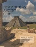
Mesoamerica's ancient cities
By William M. Ferguson,Richard E. W. Adams


Introduction to environmental remote sensing
By E. C. Barrett




Scholars' Guide to Washington, D.C., for Cartography and Remote Sensing Imagery
By Ralph E. Ehrenberg



Handbook of intermediary metabolism of aromatic compounds
By Brian L Goodwin
Skylab explores the Earth
Skylab explores the Earth
By Lyndon B. Johnson Space Center
Geographical Applications of Aerial Photography
By C. P. Lo

Air Photography and Coastal Problems
By Mohamed T. El-Ashry


Luftbildatlas Potsdam
By Mandy Kasek,Andreas Matschenz,Philipp Meuser

Das Rheinland aus der Luft
By Dirk Laubner,Winand Kerkhoff

Berlin in Luftbildern
By Günter Schneider,Christian Bahr

Über Norddeutschland
By Karl Johaentges,Jürgen Hogrefe

Ägypten
By Marcello Bertinetti,Corinna Rossi,Karin Hofmann
Historischer Luftbildatlas Tettnang
Historischer Luftbildatlas Tettnang
By Gisbert Hoffmann

Hadrian's Wall from the air
By G. D. B. Jones,D. J. Woolliscroft

Physical aspects of aerial photography
By Gerald Clement Brock

Atlas of cultural features
By Benjamin F. Richason
