Explore Books on
luftbildauswertung
1-7 of 7 Books
View Remote sensing and image interpretation By Thomas M. Lillesand,Ralph W. Kiefer,Jonathan W. Chipman,Thomas Martin Lillesand 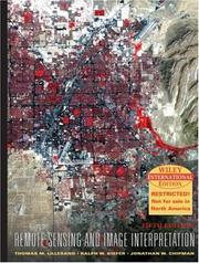
Remote sensing and image interpretation
By Thomas M. Lillesand,Ralph W. Kiefer,Jonathan W. Chipman,Thomas Martin Lillesand
View Interpretation of aerial photographs By Thomas Eugene Avery 
Interpretation of aerial photographs
By Thomas Eugene Avery
View Interpretation of Aerial Photographs Edition By T. Eugene Avery 
Interpretation of Aerial Photographs Edition
By T. Eugene Avery
View Aerial photography and image interpretation for resource management By David P. Paine 
Aerial photography and image interpretation for resource management
By David P. Paine
View Aerial photography and remote sensing for soil survey By L. P. White 
Aerial photography and remote sensing for soil survey
By L. P. White

View The Chesapeake Bay NERR in Virginia By Kenneth A. Moore,William G. Reay
The Chesapeake Bay NERR in Virginia
The Chesapeake Bay NERR in Virginia
By Kenneth A. Moore,William G. Reay