Explore Books on
maps as topic
1-24 of 35 Books



Rethinking maps
By Martin Dodge,Rob Kitchin,Chris Perkins

A handbook of biological illustration
By Frances W. Zweifel

Catalogue of the American books in the Library of the British Museum at Christmas MdcccLvi [i.e., 1856]
By Henry Stevens
The Atlantic pilot
The Atlantic pilot
By John Gerar William De Brahm
Sites perception and the nonvisual experience
Sites perception and the nonvisual experience
By Ann Middleton Kidwell
The Southeast in early maps
By William Patterson Cumming
International bibliography of vegetation maps
International bibliography of vegetation maps
By A. W. Küchler

Mapping the Victorian Social Body (Studies in the Long Nineteenth Century)
By Pamela K. Gilbert

Children's Activity Atlas
By Neil Morris,Roger Wade Walker,Creative Cartographers

Pittsburgh, her advantageous position and great resources, as a manufacturing and commercial city
By O. Ormsby Gregg
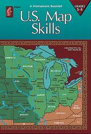
U.S. Map Skills Homework Booklet, Grades 4-6
By Jean Wolff
The Maps on File Collection
The Maps on File Collection
By Facts on File Inc


Using geographic methods to understand health issues
Using geographic methods to understand health issues
By Thomas C. Ricketts
Atlas of cancer mortality for U.S. counties, 1950-1969
By National Cancer Institute (U.S.). Epidemiology Branch.
Proceedings of the 1976 Workshop on Automated Cartography and Epidemiology
Proceedings of the 1976 Workshop on Automated Cartography and Epidemiology
By Workshop on Automated Cartography and Epidemiology (1976 Arlington, Va.)

Putting People and Health Needs on the Map
By World Health Organization (WHO)

Sixtieth anniversary, 1866-1926, Sanborn Map Company
By Sanborn Map Company