An edition of The antique county maps of Cumberland (1997)
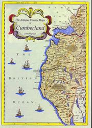
The antique county maps of Cumberland
By John Higham
Publish Date
1997
Publisher
Bookcase
Language
eng
Pages
128
Description:
This 128 page A4 softback book tells the story of the printed maps of Cumberland from the first published map of the county by Christopher Saxton in 1579 to the Ordnance Survey maps of the 1860s, with sections on later 19th century maps, road maps, town plans, etc. There are descriptions of some 150 different maps, over 130 of which are illustrated, making this an invaluable work of reference for the map collector as well as for anyone with a general interest in the history of the county of Cumberland. As the maps described were, for the most part, published for each English county, the book can also be used as a general reference book for other counties where specialist publications do not exist.
subjects: antique, map, speed, saxton, morden, cary, moule
Places: Cumberland, Carlisle, Penrith, Whitehaven, Cockermouth, Keswick, Workington, Brampton, Wigton
Times: 1578-1880