An edition of Surveying the Shore (2006)
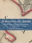
Surveying the Shore
Historic Maps of Coastal Massachusetts, 1600-1930
By Joseph G. Garver
Publish Date
September 11, 2006
Publisher
Commonwealth Editions
Language
eng
Pages
205
Description:
"Since British, French, and Dutch colonists vied for the territory we call New England, cartographers have drawn the region to suit their political and commercial goals. Cartographic historian Joseph G. Garver analyzes and illuminates ninety historic maps, connecting them with key developments in New England history and demonstrating how a community's maps reflect its view of the world" -- Book jacket.
subjects: Surveys, Coasts, History, Maps, Shorelines, Massachusetts, maps, Cartography, Massachusetts, Historical geography, Coastal mapping